 Camp Observer
Safford-Morenci Trail
Show on map928-348-4400blm_az_sfoweb@blm.gov
Safford Field Office, 711 S. 14th Avenue
Safford, AZ 85546-3321
Safford, AZ 85546-3321
Directions
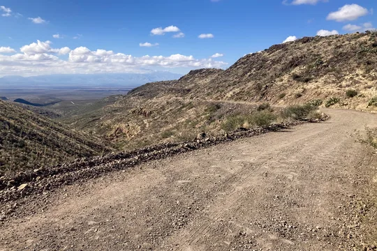
The West Trailhead near Bear Springs is about 12 miles northeast of Safford via the Solomon Pass and Salt Trap Roads. To reach the trailhead, take 8th Avenue north out of Safford. A half mile after crossing the Gila River bridge, take the right fork onto Airport Road. Drive 4.3 miles to Aviation Way. Turn left onto Aviation Way, then another immediate left onto the paved unsigned road. This is Solomon Pass Road, which you follow for 8.0 miles to the Solomon Pass - Salt Trap Road Junction. Take the left fork onto Salt Trap Road and follow 1.8 miles. Turn left and continue about 4 miles west to the West Trailhead. If you reach a storage tank with corrals on Salt Trap Road, you've missed the turn. A 4WD high-clearance vehicle is needed for portions of the last 4 miles.
To reach the East Trailhead (6 air miles west of Morenci), take the Lower Eagle Creek/Black River Road off of Highway 191, just north of Morenci. The turnoff is about a quarter mile past a historic hillside cemetery on your right. Take the left into what appears to be a dirt parking area; the road begins there. The Eagle Creek Road begins there. You will need to ford Eagle Creek just below the water pipeline at the ranch house, continue on for about another 4 miles. The trailhead is signed. Although the Lower Eagle Creek/Black River Road is a maintained gravel road, the river crossing may require a high-clearance vehicle during high water events.
Parking pull outs are available at either end of the trail at signed trailheads. Access to the west trailhead is very difficult and requires four-wheel drive and high clearance. The east trailhead also requires four-wheel drive, high clearance, and forging Eagle Creek.
Fees
A recreation permit is needed for crossing Arizona State Trust Land one mile southwest of the East Trailhead. Permits are available by mail or in person at the Arizona State Land Office in Phoenix, Tucson, and Flagstaff, and from the Arizona Public Lands Information Center in Phoenix.
A San Carlos Apache Tribal recreation permit should be obtained if you wish to cross the short section of the trail that passes through the reservation in T. 4 S., R. 28 E. Permits are available from the Tribal Recreation and Wildlife Department in Peridot, or from convenience stores in Safford and Pima.
Stay Limit
Camping along the BLM-managed portions of the trail is allowed without a permit. Other restrictions may apply for the Arizona State Trust Land or San Carlos-Apache Tribe Land along the trail. For BLM lands, the stay limit for dispersed or undeveloped camping is 14 days within any 28-day period within a 25-mile radius of your campsite.
Reviews
No reviews yet