1 of 6 photos
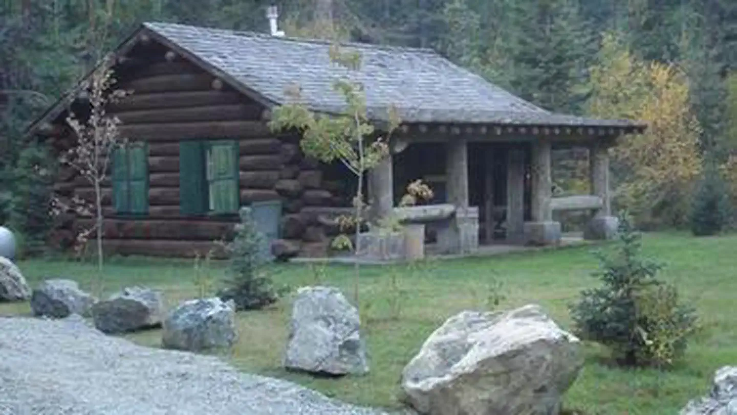
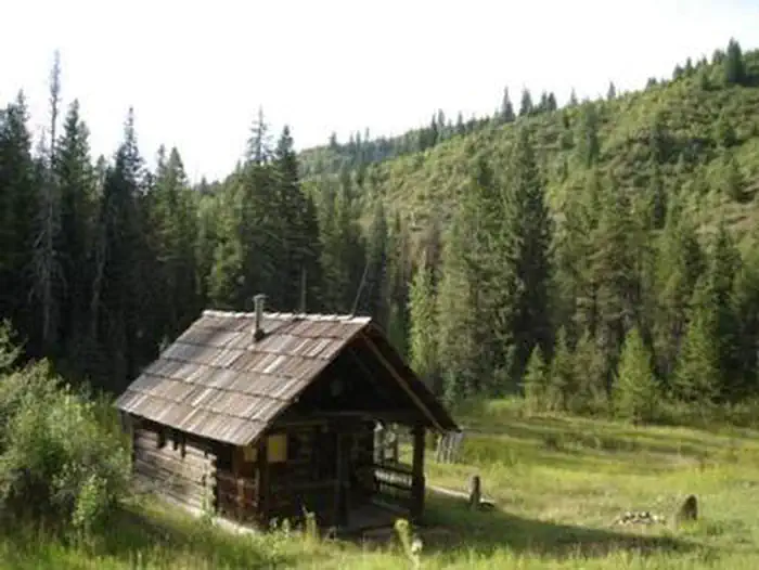
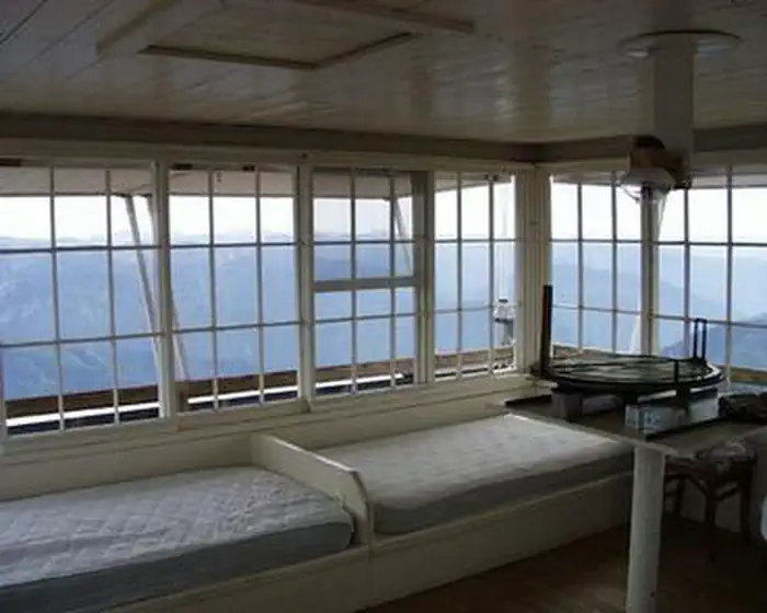
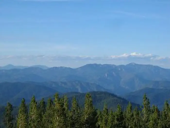
Scurvy Mountain Lookout
Directions
Scurvy Mountain Lookout is approximately 35 air miles northeast of the
community of Pierce, Idaho on the North Fork Ranger District of the Nez Perce-
Clearwater National Forest.
The last 50 miles of travel to the cabin from Pierce are mostly single lane,
gravel surfaced roadways that may be peppered with large potholes and rocks,
the last 4 miles being rutted 2 track road requiring 4X4 high clearance
vehicles operated by experienced operators and 5 miles of multi-use, moderate
difficulty trail. Seasonal conditions permitting, the cabin is also
approachable from I90 via Superior MT, with the addition of a high mountain
pass that is usually impassible from late Oct to mid-July with 50 miles of
gravel/dirt road conditions including 4 miles being rutted 2 track road
requiring 4X4 high clearance vehicles operated by experienced operators and 5
miles of multi-use, moderate difficulty trail.
To plan your trip accordingly, visitors are strongly advised to consult a map,
the forest web site, and seasonal conditions in advance of making reservations
as well as prior to travel since there are no services available on the
forest.
To approach Scurvy from Idaho via US HWY 12 and State HWY 11: Locate French
Mountain Road, also known as Forest Service Road FSR 250, on the east side of
State HWY 11 (Main St) on the south end of Peirce Idaho (approximately 3/4 of
a mile from city center). Travel on FSR 250 for approximately 45 miles (be
sure to stay to the right after crossing the North Fork of the Clearwater
River at the “Historic Bungalow Ranger Station site”) At the Kelly Forks work
center take the 255 Rd across the North Fork of the Clearwater River 11 miles
to the FSR 255/FSR 581 junction. Follow FSR 581 on across Kelly Creek for 4
miles to trail TR 524 trailhead at East Saddle. Then take TR 524 for the
remining 5 miles to Scurvy Mountain Lookout.
Conditions permitting, Scurvy Mountain Lookout can be approached from US I90
via Superior MT by locating the River St under pass of US I90. Follow River St
to Diamond Match Rd on the south side of US I90 then follow Diamond Match Rd
southeast past Riverbend where the road curves to the south and becomes FSR
250 traveling 25 miles to Hoodoo Pass at the Idaho-Montana state line.
Continue southwest on FSR 250 for approximately 11 more miles to the FSR
250/FSR 255 junction, take a left and follow FSR 255 approximately 12 miles up
over Deception Saddle down to the FSR 255/FSR 581 junction. Turn left and
follow FSR 581 for 4 miles across the bridge over Kelly Creek to TR 524
trailhead at East Saddle. Then take TR 524 for the remining 5 miles to Scurvy
Mountain Lookout.
*NOTE: Hoodoo Pass, is a remote mountain pass that rises to 6,000 ft elevation and is typically impassable due to snow from late Oct until mid-July when the pass melts out. FSR 581 is a steep narrow single lane road with limited pullouts and its native soil surface can be slick and rutted. TR 524 is a high traffic multi use trail that has multiple steep sections, with many “Kelly” humps for water drainage.
Reviews
Popularity
No popularity data yet
Location