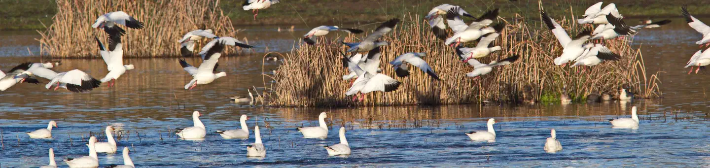
1 of 1 photo

Sutter National Wildlife Refuge

Sutter NWR was established in 1945 with funds from the Migratory Bird Hunting and Conservation Stamp Act (today it is known as Federal Duck Stamp) and the Lea Act. It was established to provide feeding and nesting areas for migratory birds and alleviate crop depredation.

About 80% of the refuge is located in the Sutter Bypass. During major flood events, the Bypass diverts winter flood water from the Sacramento River, which may cover portions of the refuge with up to 12 feet of water.

Waterfowl are present September through April and numbers peak later than most other refuges in the Complex


between January and February. Sutter NWR regularly supports wintering peak populations of over 150,000 ducks and 70,000 geese.

The mixed riparian forest habitat on the refuge is important for breeding and migrating passerine birds, and supports a large heron/egret rookery. The refuge provides habitat for several Federal and State endangered and threatened species, including giant garter snake, Chinook salmon, yellow-billed cuckoo, and Swainson's hawk.

There are limited wildlife viewing and photographic opportunities from Hughes Road, which bisects the refuge.

Directions

Check station is approximately 11.2 miles southwest of Yuba City **From Hwy 20, Yuba City:** * from Hwy 20 in Yuba City, head south on Hwy 99 * go 5 miles south on Hwy 99 * go 5.5 miles west on Oswald * turn left at Schlag Rd onto gravel road and continue 0.6 miles to Check Station * Click here for a map with directions **From I-5, at Williams:** * go 32.5 miles east on Hwy 20 to Yuba City * go 8 miles south on Hwy 99 * go 5 miles west on Obanion * go 0.5 miles north on Levee Rd to Parking Area B * Click here for a map with directions **From I-5, at Sacramento:** * go 26.5 miles north on Hwy 99 toward Yuba City * go 5 miles west on Obanion * go 0.5 miles north on Levee Rd to Parking Area B * Click here for a map with directions

Reviews

No reviews yet
Location

Nearby Parks