1 of 1 photo
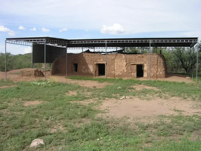
Defensive Sites of Dinetah
Popularity
No popularity data yet
Directions
Simon Canyon Ruin
Simon Canyon Ruin can be reached by driving to the parking lot and picnic area
for Simon Canyon Recreation Area, located on the north side of the San Juan
River, 3.5 miles below Navajo Dam. A moderate half-mile hike leads to the
site.
Frances Canyon Ruin
To access the site, take NM Hwy 527 north from US 64 to mile marker 11, and
turn left (west). Follow the road to the mesa top. Continue to follow the road
to a "T" intersection approximately 2.5 miles from the base of the mesa. Turn
right (south) and continue an additional 0.5 miles, then keep left at the
Y-intersection, continue about 400 feet, then turn left (northeast), and
follow the pipeline about 0.2 miles to the parking area. A short, gentle hike
leads to the site.
Crow Canyon
To reach the petroglyphs, a high-clearance, four-wheel drive vehicle is
recommended. Take County Road 4450 for 19 miles south from its junction with
Highway 64. Follow the signs across Largo Wash, and then turn north and drive
approximately one mile to the mouth of Crow Canyon. (NOTE: Do not cross either
wash when water is present, and caution should be used when sand is either
very wet or very dry. Get out of your vehicle to check the condition of the
wash). Signs direct you to the main panels at the mouth of the canyon. To see
the "44 Panel," follow the road up the canyon, and then park at the well pad.
Signs direct you to the trail to the "44 Panel," a hike of about 3/4 of a
mile.
Tapacito Ruin
From the bridge at Largo School Ruin, continue south on the Largo Canyon Road
for approximately 2.5 miles, to where Tapacito Creek enters Largo Canyon.
Cross the wash (there is no bridge - only cross the washes if there is no
water present). Follow the road up Tapacito Canyon for approximately two more
miles, and then take the road across the creek. Double back on the road on the
other side of the creek toward Largo Canyon for approximately 2.4 miles and
park at the small parking area. The pueblito is only a short walk from the
parking area.
Split Rock Ruin
To access Split Rock Ruin, continue along the road past the parking area at
Tapacito Ruin for an additional half mile. A two-track trail can be seen
leading east from the main road at this point. Park alongside the main road
and follow the easy trail to the interpretive sign at the base of the cliff.
Hooded Fireplace Ruin
To reach Hooded Fireplace, travel south along the Largo Canyon Road (County
Road 4450) for 1.8 miles south of the bridge at Largo Canyon School. Turn west
up a steep road that climbs out of the canyon to the first bench. Keep to the
right and continue north for another two miles. Hooded Fireplace is clearly
visible above the road to the west.
Largo School Ruin
To reach Largo School Ruin, continue north past Hooded Fireplace approximately
a quarter of a mile, to a small parking area on the east side of the road.
From the parking lot it is an easy half-mile hike to the pueblito, mostly
following an abandoned two-track road.
Reviews
Location