1 of 1 photo
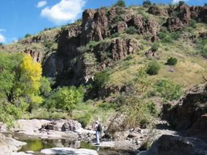
Apache Box Wilderness Study Area
Popularity
No popularity data yet
Directions
From the intersection of highways 180 and 78 (approximately 46 miles west of
Silver City), drive just over 9 miles west on 78 to Mule Creek and turn south
on Brushy Mountain Road. Drive 15 miles on Brushy Mountain Road, passing
numerous marked and unmarked intersecting routes (most notably passing Radar
Station Road at 12.2 miles). At 15 miles you will come to a locked gate. Park
clear of the gate and follow the fence line to the west to avoid the private
land. Staying on National Forest land north of the fence, eventually turn
south into the WSA. You'll need to be able to read a map to navigate into the
WSA as this is rugged terrain without a trail.
Stay Limit
14 Days
Reviews
Location